

Rennsteig cycle path
Conquer the Rennsteig by mountain bike
SAmbitious mountain bikers have found a perfect challenge in the Thuringian Forest for several years now. The Rennsteig cycle path has been established along the famous Rennsteig trail. The long-distance cycle path also stops off in Oberhof.
The Rennsteig cycle trail was opened on 19 June 2000. The steadily increasing number of hikers and mountain bikers in the Thuringian Forest prompted the region’s tourism experts to create the Rennsteig cycle trail. The original Rennsteig route also presents many cyclists with major challenges. The Rennsteig partly leads over very rooted, narrow trails. The root and gravel paths are only attractive for particularly experienced mountain bikers. This gave rise to the idea of creating an alternative. The Rennsteig cycle path is varied and leads over tarmac and gravel as well as natural forest floor.
The result is a route that is just as attractive for families as it is for sporty mountain bike fans. Today, you can also increasingly see older cyclists enjoying the Rennsteig Cycle Trail with the help of an e-bike.
Facts about the Rennsteig cycle path
Condition of the Rennsteig cycle path
The Rennsteig cycle path has a total length of 195 kilometres. This makes the cycle trail almost 30 kilometres longer than the actual Rennsteig hiking trail. Overall, the cycle path is based on the original, but only around 26 kilometres are identical. Over a distance of around 113 kilometres, you cycle on forest paths and non-public roads. Normal road traffic is also to be expected on some kilometres. (This corresponds to around a quarter of the total route). The constantly changing surfaces of the route, such as tarmac, sand, forest floor or gravel, offer a pleasant change. This makes the Rennsteig cycle route very attractive.

Division of the Rennsteig cycle path
The Rennsteig Cycle Trail is divided into 85.8 km of tarmac roads and tarmac cycle paths and byways, 109.2 km of easily rideable gravel, forest, meadow and woodland paths and 0.2 km of paths, gravel and root trails and other challenging sections. There are 0.0 km of push tracks.
The route is marked with the green Rennsteig R with the cyclist. A good and up-to-date map is highly recommended, or you can download the GPS data from the Thuringian Forest tour portal.
Extract of stages – Rennsteig cycle route around Oberhof
Saukopfmoor nature reserve – 830 metres above sea level
The tarmac forest path makes a wide loop around the Saukopfmoor nature reserve. This is located north-west of the town of Oberhof, in the direction of Grenzadler. Our tip: The Saukopfmoor viewpoint, with a marvellous view of Oberhof.

Grenzadler Oberhof – 837 metres above sea level
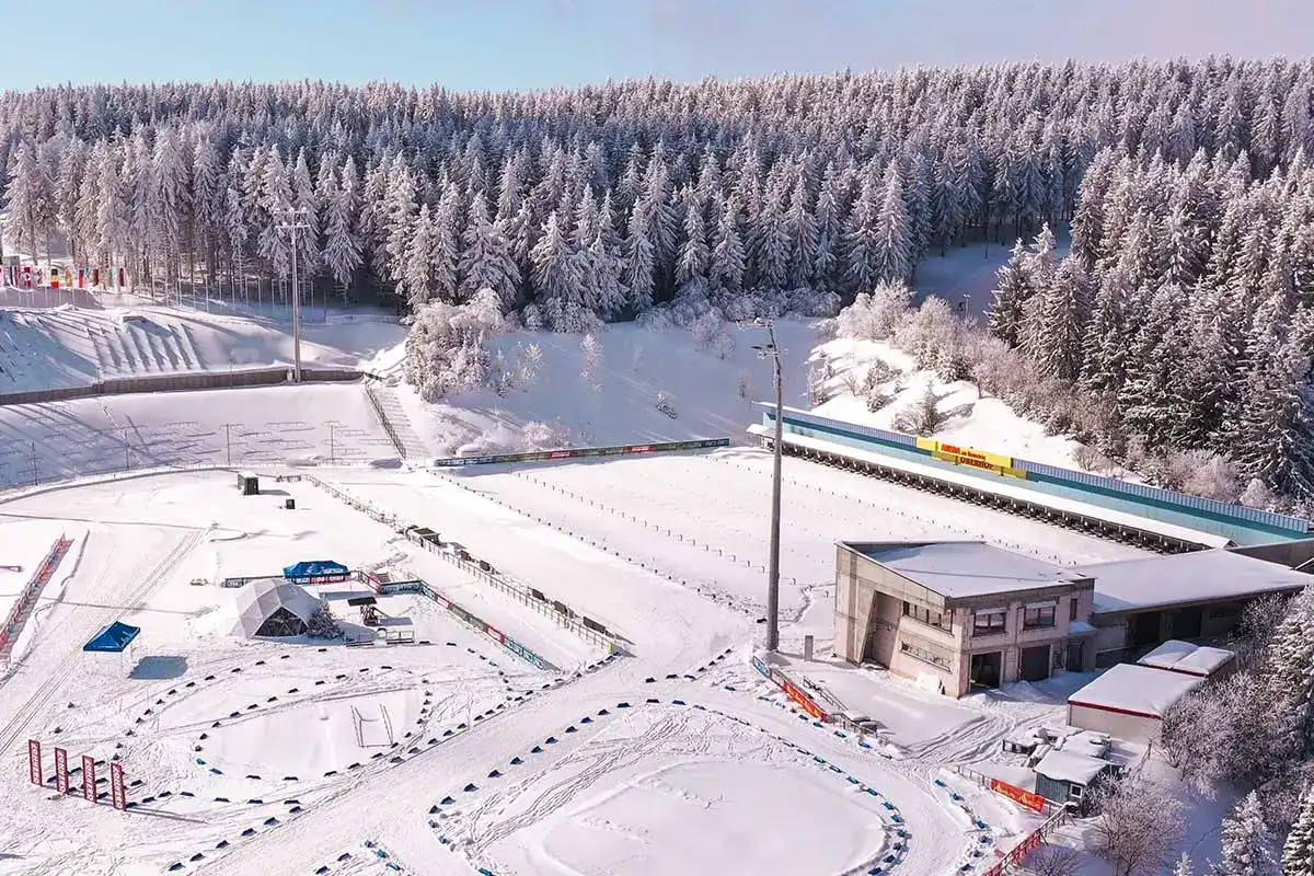
The Rennsteig Cycle Trail rejoins the classic Rennsteig at the Grenzaldler near Oberhof. The name “Grenzadler” comes from a Prussian boundary stone (with the Prussian eagle shield) on the road crossing the Rennsteig from Oberhof to Ober- or Unterschönau. Today you are in the winter sports heart of Oberhof and Thuringia. The Grenzadler is home to the biathlon stadium, the indoor ski hall and the other training and competition venues of the Federal Training Centre. About 1 kilometre in the direction of Oberhof you will find the bobsleigh and luge track. About 2 kilometres in the direction of Oberschönau you can see the well-known ski jump in Kanzlersgrund.
Stein 16 – 890 metres above sea level
The famous Stein 16 is located at the junction between the Zellaer Leube and the Rennsteig. Here the Rennsteig cycle path leaves the original Rennsteig again. Turn left and continue in the direction of Oberhof. Shortly before the edge of the village – the first houses can already be seen – keep right. The narrow path ends on a road on which you continue to the right. The path then leads you under the L 3 247 road, past the “Naturfreundehaus” and on towards Rondell.
Rondell near Oberhof – 826 metres above sea level
At the roundabout you reach the Rennsteig again. The obelisk at this crossroads was erected to commemorate the construction of the road linking Gotha and Coburg in 1830-32. Approximately 100 metres south of the roundabout is the Rennsteiggarten, a botanical garden for low and high mountain flora. We also recommend a detour to the Bärenstein, approx. 1.5 kilometres away. From here you have a magnificent view towards the Rhön and the Oberhof railway station, which is around 200 metres below. The next stage continues along the Rennsteigstraße towards Schmiedefeld. This is followed by a longer and only occasionally interrupted section of road.

Viewpoint on the Beerberg – 920 metres above sea level
The highest mountain in Thuringia, the Großer Beerberg, is not directly on the Rennsteig cycle path (the original Rennsteig crosses the mountain near the summit). The Rennsteig road makes a small detour around its summit. In this area, there is a viewpoint directly on the left-hand side of the road. From here you have a marvellous view of the Thuringian main ridge, which flattens out to the north. From here, the Rennsteig cycle path continues in the direction of Schmücke. You now leave the area around Oberhof.
