

Secrets and legendary peaks about Beerberg & Schneekopf
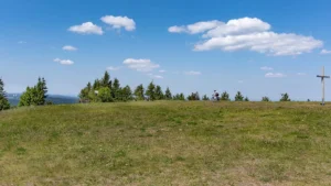
In 1946, a hurricane caused such severe wind damage that the summit has been treeless ever since. The Schneekopf area was declared a restricted military area on 1 March 1960 and served as a Soviet telecommunications reconnaissance station until it was cleared on 15 February 1994. Today, only the telecommunications tower erected in 1958, which was originally operated by the German Post Office and the Ministry of State Security, bears witness to this.
The old observation tower
From 1852 until it was blown up on 18 August 1970, an octagonal stone observation tower stood next to it, with a lookout pulpit that reached the 1000 metre mark. Until it was closed, there was also a serviced mountain hut, the “Gehlberger Hütte”, run by the Gehlberg original “Schneiders Ernst”, which also served as a starting house for alpine skiing competitions in the “Hölle”. Below the summit, which was renaturalised in 1996/1997, lies the 38.5-hectare Schneekopfmoore nature reserve on the Teufelskreis.
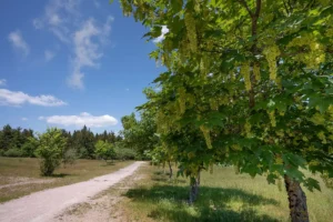
About one kilometre from the summit and immediately south of the Teufelskreise is the Schmücke in the Gehlberg district and also on the Rennsteig. For many hikers, the well-known forest inn is the starting point for a visit to the Schneekopf summit. For car drivers, there is also a large car park on the road towards Oberhof, from where it is about 1.5 km on foot to the summit.
In Gehlberg, four kilometres and 250 metres in altitude from the summit, there is the Schneekopfverein e. V., which was founded in 1990. Its members campaigned for the renaturation of the area after the withdrawal of the Russian armed forces in 1994, advocate gentle tourist development of their local mountain and keep the memory of the legend of the wildlife accident at the Teufelskreisen alive with their annual Jägersteinfest held on the mountain in mid-September.
The Schneekopf reaches 1,000 metres above sea level
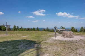
In the 1990s, there was an idea to raise the mountain to 1,000 metres above sea level in the course of renaturation (for example, using excavated material from the construction of the A 71 motorway). This would have made it the only thousand metre peak in Thuringia and the Thuringian Forest would have been added, albeit unnaturally, to the list of German low mountain ranges above 1000 metres. After lengthy discussions, construction of a new tower began in September 2007, and since its completion in June 2008, the peak has stood at 1001 metres.
The Großer Beerberg is an extinct volcano and, at 982.9 metres above sea level, the highest elevation in the Thuringian Forest and Thuringia. It is located to the north of Suhl-Goldlauter in the Ilm district and consists of porphyry rock.
Vessertal-Thuringian Forest Biosphere Reserve
One of the few preserved raised bogs in the Thuringian Forest is located on the summit of the Beerberg. It is protected as part of the Vessertal-Thuringian Forest Biosphere Reserve. Access to the highest point of the mountain is therefore not permitted. Until the end of the 1980s, there was a viewing tower on the mountain, which has since been demolished. Later, a small platform was built just below the summit at Plänckners Aussicht, from where there is an excellent view to the south and south-west. The Rennsteig trail also runs here on the section between Oberhof and Schmücke.
Wonderful views over the Thuringian Forest
Between the summit of the Großer Beerberg and that of the neighbouring 978 m high Schneekopf to the east (the second highest mountain in Thuringia) lies a saddle, which the two peaks rise just 60 m above. In a westerly direction, there are various neighbouring elevations which, although they are considered mountains by their own name, are largely to be classified as secondary peaks of the Großer Beerberg due to their low dominance and prominence.
- Wildekopf – 943 m; 1.3 km to the west-north-west)
- Sommerbachskopf – 941 m; 1.3 km to the north-west
- Unterer Beerberg – 891 m; 700 m south-west
- Farmenfleck – 890 m; 2.8 km north-northwest
- Spitzer Berg (also: Spitziger Berg) – 882 m; 3.4 km north-west; already a relatively independent mountain in the immediate vicinity of the federal road 247 between Oberhof and Zella-Mehlis
